A National Parks road trip in Utah is an unforgettable experience, allowing you to enjoy the stunning natural beauty of the west at your own pace and in your own time.
You can enjoy road trips in Utah at just about any time of the year, from the hot (but busy) summers to the cooler, quieter winters.
Ready To Travel? Don't Go Without Travel Insurance.
I recommend SafetyWing Nomad Insurance, an affordable travel insurance offering automatic monthly payments that you can cancel anytime. I've been using it since 2019, and I can assure you it's the perfect solution for nomads like you and me. Learn more by reading our SafetyWing review.During your Utah road trip, you should expect stunning landscapes that are incredibly diverse, with fascinating rock formations, breathtaking sunsets, white-capped mountain peaks, and walking trails ranging from the sedate to the adventurous!
This region of the United States also offers some of the best opportunities for star-gazing in the country, with all National Parks designated as International Dark Sky Places.
Utah’s National Parks are vast, and you could easily spend several days in just one without experiencing all that it has to offer.
So this Utah National Parks road trip itinerary is designed to help you visit every one of the state’s five national parks within seven days and see the highlights of each.
This will be a very packed schedule but a rewarding one during which you will see the very best of everything!
This itinerary starts at Las Vegas, with the first stop – Zion National Park – a 2.5 to 3-hour drive away.
Haven’t rented a car yet? We recommend you use Discover Cars to find a car rental. If you prefer to travel in the area with an RV, browse affordable options on RVshare.
Utah National Parks Itinerary
- Drive from Las Vegas to Zion National Park (days 1 and 2 )
- Bryce Canyon (day 3)
- Capitol Reef (days 4 to 5)
- Arches (day 6)
- Canyonlands and Dead Horse Point State Park (day 7)
Zion National Park
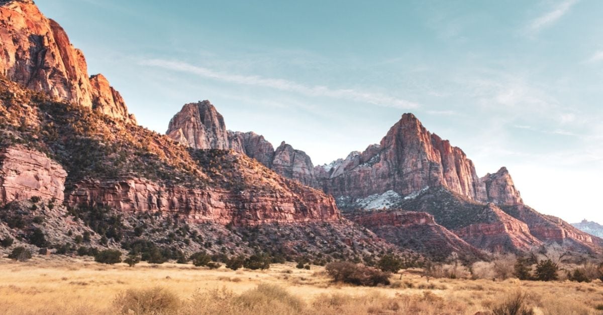
The 3rd largest of Utah’s National Parks, Zion is located just adjacent to the quaint town of Springdale.
The drive from Las Vegas covers 160 miles, so if you want to stop and stretch your legs en route, why not pay a visit to St. George Historic Downtown?
Here you can take a self-guided walking tour or learn more about the area’s Mormon routes at the Pioneer Museum.
If you plan on camping at Zion you can do so within the park itself, but if you are looking for accommodation then you may prefer to stop in Springdale, which is cheaper and more modern.
An efficient shuttle service provides easy access to the Park should you choose not to drive, with the trailheads for many of the hikes located along its route. Be prepared to queue at busy times!
I recommend driving the 72 miles onwards to Bryce Canyon National Park at the end of the second day, which should only take you around 1.5 hours.
That way, you can stay at Bryce, ready for an early start to catch the spectacular sunrise at Sunrise Point the following morning.
Zion National Park is divided into two main sections – Zion Canyon and Kolob Canyon (the Kolob Canyon Road is 5 miles long and makes a great drive, with amazing views of red volcanic rock).
Two of the most popular highlights of a visit to Zion National Park are the Narrows and Angel’s Landing hikes, both of which can be accomplished within a two-day visit to the Park.
The Angel’s Landing hike begins at The Grotto (stop #6 on the shuttle route) and has been dubbed by many ‘the scariest hike in America’.
Cross the Virgin River from the stop to get to the trailhead, where you can see Angel’s Landing ahead of you, then begin your strenuous ascent to the top.
Whilst the views are spectacular, the main attraction of this hike is the final and thrilling scramble along the very narrow ridge, with chain-assisted sections.
It is just a few feet across at its narrowest point, with drop-offs on either side and is not for the faint-hearted!
Best enjoyed in spring or fall, this hike is a demanding 3 to 5 hours, with an elevation of 1500 feet.
If you don’t want to complete the whole thing – or are traveling with children – just hike as far as Scout Lookout instead.
The Narrows hike begins at stop #9, the Temple of Sinawava, and takes in the narrowest section of Zion Canyon.
You have two options here, the easiest of which is to hike for a mile along the paved, wheelchair-accessible Riverside Walk.
To go further, you will need to hike in the River itself. Because there is no trail, most people choose to wade just a short distance upstream.
Should you wish to go further, you can hike as far as Big Spring without a permit – a 10-mile round trip, passing Mystery Falls and the narrow passageways of Wall Street on the way.
The Narrows is best experienced during late spring and summer, as the water levels are lower and the water is warmer.
But it is always important to check the weather forecast and flash flood potential before setting off.
A good option for your second day is to take the 57 mile Zion Canyon Scenic Drive, which passes the Virgin River and many of Zion’s most famous landmarks.
During peak season, part of this route is only accessible via the shuttle service.
Other Zion highlights include Kolob Arch, one of the largest freestanding arches in the world, located in Kolob Canyons District, and the Canyon Overlook Trail, one of the Park’s easiest and most photographed trails.
This 1-mile round trip starts 100 feet from the parking lot.
Alternatively, you could spend 2 hours to half a day on the trail to Observation Point, which takes you to an elevation of more than 6,500 feet at the top of Mount Baldy, with a lofty view of all of Zion’s main attractions.
Beware, though – the 200-foot ascent of the 8-mile round trip hike is challenging!
Bryce Canyon National Park
The drive to Bryce Canyon National Park from Zion is easy – just take the Zion-Mount Carmel highway east from the park, then route 89 north until you reach route 12, which takes you to Bryce.
If you want an interesting stop on the way, pay a visit to Coral Pink Sand Dunes State Park, which features constantly shifting red sands and dunes which are great for everything from off-roading to non-motorized activities.
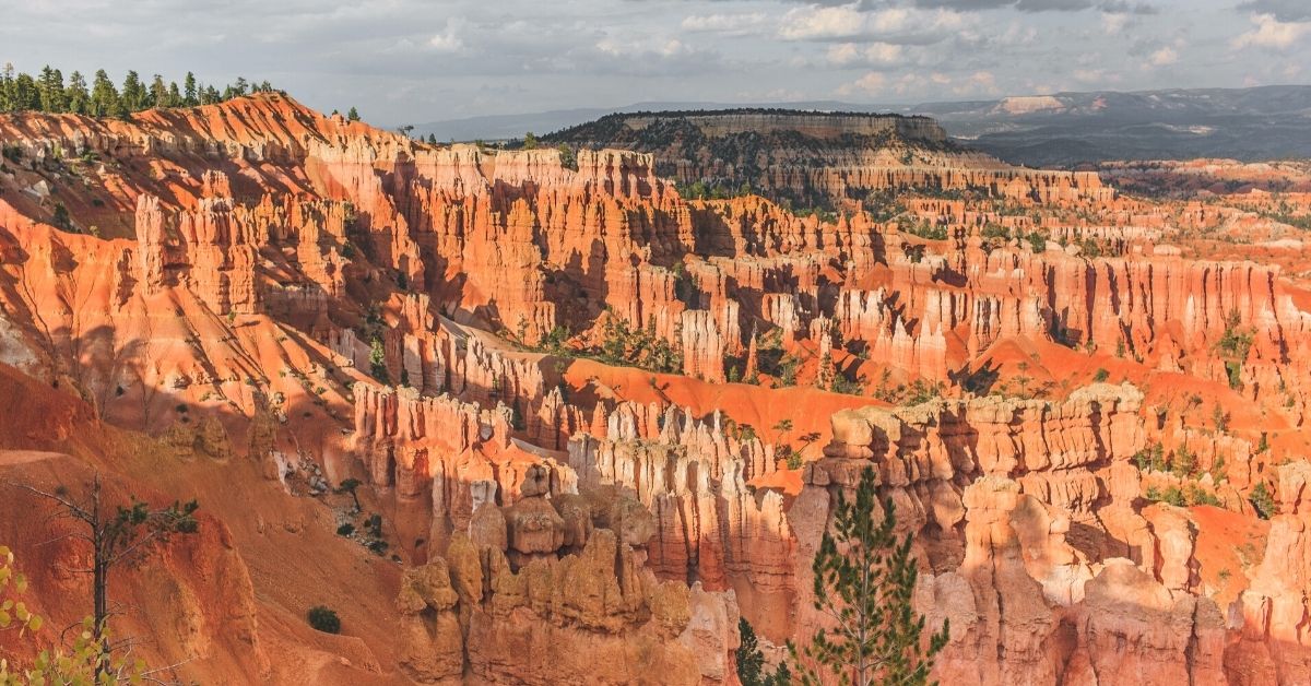
Family-friendly Bryce Canyon National Park is the smallest of the 5 parks, so it is easy to visit in one day.
It also has the most surreal landscape, an interesting combination of red rock desert – filled with the largest collection of hoodoos on earth – and lofty evergreen forests.
In fact, the alpine groves surrounding the park make it an excellent spot for camping!
Bryce Canyon National Park is completely different from Zion, and all of Utah’s other National Parks, mainly because of its elevation of between 8 to 9000 feet.
This gives rise to cooler air and the very strong winds that have contributed to this unusual landscape.
On arrival at Bryce, you have 2 main camping grounds to choose from, or the popular Bryce Canyon Lodge, with 114 rooms.
Be sure to check the sunrise times, and set your alarm to wake you around half an hour before civil twilight (rather than sunrise).
This will give you time to head to Sunrise Point, ready to set up your camera to capture the stunning red and orange hues as the sun breaks over the horizon.
A shuttle runs back and forth along the length of the Park, covering the 17 miles south from the visitor center to Rainbow Point.
But for a Utah road trip in Bryce, I recommend taking the 38 miles round trip along the Bryce Canyon National Park Rim Road.
From here you can easily access 13 viewpoints that give you spectacular views over the amphitheaters.
If you are looking for a short, easy walk, the family-friendly 1-mile trail between Sunrise Point and Sunset Point is ideal.
Otherwise, the 3-mile round trip Navajo Loop Trail is a good choice, being both easily accessible and with some great views along the way.
Look out for the 700-year-old Douglas fir rising from the middle of a canyon almost as soon as you descend, then follow one of the many trails leading into the hoodoos further on.
For the remainder of the day, you can choose between the popular Fairyland Loop – an 8-mile round trip – or follow the 3-mile round trip Queens Garden Trail down into the amphitheater from Sunrise Point.
Although it is steep at first, you are rewarded for your efforts by some magnificent views.
In the summer, you can access Wall Street from this trail – a narrow gorge with towering walls on either side.
If you have time, be sure to check out the views from Bryce Point and Inspiration Point before you leave the Park.
Capitol Reef National Park
The morning after your stay in beautiful Bryce, it’s time to head off on the 122-mile drive to Capitol Reef National Park, which should take you around 2.5 hours.
Although there are quicker ways to get there, the best route by far is via Scenic Byway 12 (also known as Highway 12) – considered to be the 2nd most beautiful highway in the world!
The view as you approach Capitol Reef is just one of the reasons why – it is a truly stunning vista of multi-hued rocks and rolling hills.
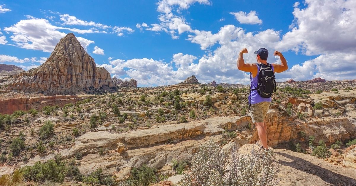
Although the 2nd largest of the 5 National Parks, Capitol Reef receives fewer visitors than Bryce or Zion and has a very different landscape – vast, seemingly infinite, and reminiscent of another planet.
It preserves the Waterpocket Fold – a wrinkle in the earth’s surface that extends for 100 miles.
There are a couple of primitive, free campgrounds further into the Park, but I recommend staying at the Fruita Campground next to the Fremont River for your 2 nights here.
Next to the river is the start of the Hickman Bridge Trail – an easy, 1 hour, 1.8 miles (round trip) hike to a large, natural arch and one of Capitol’s highlights, where you can see amazing petroglyphs carved into the rocks.
Before reaching Hickman Bridge you will also see a smaller natural arch – Nels Johnson Natural Bridge.
Whereas you usually need to get out of your car to see the best of Utah’s National Parks, Capitol Reef is the exception and is ideal if you want to see the sights without hiking.
This is thanks to the 8 mile Capitol Reef Scenic Drive, which is dotted with viewpoints that make it possible to see everything without leaving your car
That being said, there are several scenic hikes to enjoy, one of the most popular being the Grand Wash Trail which starts from the parking lot at the end of the Grand Wash gravel road, a dirt spur branching off from the Scenic Drive.
This is an excellent hike for the whole family, with just a 200-foot change in elevation and a 4.4-mile round trip taking around 3 hours.
The trail descends into a very deep wash with sheer walls, narrow sections just 15 feet wide, and cutting into the Navajo sandstone in its deepest section.
For a shorter hike to start day 2, take the trail to Cassidy Arch from the same parking lot – a 3.1-mile round trip that should take around 2 hours.
The Capitol Reef Scenic Drive comes to a dead-end at Capitol Gorge Road. Not to be missed, this 2.2 miles (one way) drive is one of the best in the Park and takes you past enormous canyon walls.
At the end of it, you will find the trailhead for the easy, 2 miles (round trip) Capitol Gorge trail.
Another highlight on this Utah itinerary is where you will find the Pioneer Register – the names of miners and settlers from the late 1800s carved onto the walls of the canyon.
Also not to be missed is the Panorama Point viewpoint – as you admire the expansive views you will appreciate how it got its name!
After an overnight stay, head east out of Capitol Reef National Park and on towards Moab for the final 2 destinations on your Utah National Parks road trip.
On the way, I highly recommend stopping off at Goblin Valley State Park – an easily accessible field of mushroom-shaped rocks (the Goblins) that are especially popular with kids.
Moab
Moab serves as the perfect base camp for visiting both Arches and Canyonlands National Parks, which are only about an hour apart from each other.
One of the largest towns in southern Utah, it has a bustling, lively atmosphere and is a mecca for all those who love outdoor pursuits, from mountain biking and off-roading to canyoneering and river rafting.
Once settled in your lodgings in Moab, it’s time to head to Arches National Park, just a 10-minute drive away.
Arches National Park
On arrival at Arches, you will see exactly where it got its name. One of the smallest of Utah’s 5 parks, it is home to more than 2000 natural arches, along with huge mesas, balanced rocks, and hoodoos.
The Park has one main road running through it which passes many of its main attractions and viewpoints, making it perfect for families.
If you feel up to the challenge – you might want to start your day here with a visit to the Fiery Furnace!
This labyrinth of narrow passageways – with steep drop-offs – spans a difficult-to-navigate 2-mile route that can take 2 to 3 hours, depending on how lost you get!
You need a hiking permit to enter, or you can opt to join a ranger-led tour. After Fiery Furnace, I recommend taking the moderately difficult hike to Delicate Arch.
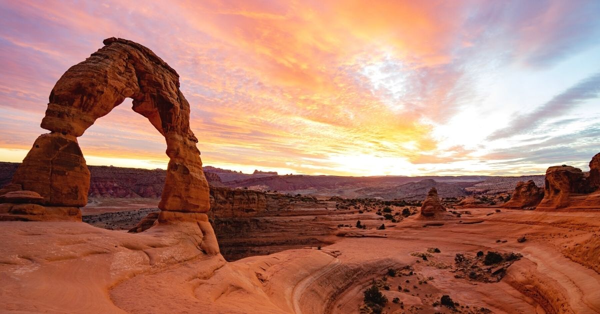
The longest natural arch in America, Delicate Arch appears on Utah license plates and was the arch beneath which the Olympic torch was carried in 2002!
It is also one of the arches that you will need to hike to see – it is not visible from the road.
Starting at Wolfe Ranch Cabin, the hike is a 3-mile round trip hike with 480 feet of elevation gain and should take around 2 to 3 hours.
You could then take the much easier hike to Landscape Arch, which takes around an hour and starts at the Devils Garden trailhead.
As a more challenging alternative to the Landscape Arch hike, you could do the Devil’s Garden hike (which actually includes Landscape Arch anyway)!
This 7.2-mile hike takes around 3 to 4 hours and is quite spectacular, taking in 8 arches in total and providing exceptional views from the sandstone fins.
After this, you will head back towards the Park’s entrance, so take time to stop off at a few of the sights along the way!
Both Skyline Arch and Sand Dune Arch are accessible via short, easy trails, and Balanced Rock is visible from the road.
To end your day, visit the Windows section of the Park. Here you can see the North and South Windows, plus Turret Arch.
If you have time, take the short trail in the opposite direction of Windows to see the lovely Double Arch, which will add an extra hour or so to your visit.
Canyonlands National Park
On your final day, a 45-minute drive south from Moab will take you to Canyonlands, the biggest park of the five.
Canyonlands is divided into four districts – Island in the Sky, The Needles, The Rivers, and The Maze, with several hours of driving between each.
As you will only be spending a day here, the best option is to focus on the more easily accessible Island in the Sky.
Possibly the area’s main attraction – and the best place to start the day – is at the Mesa Arch. Set your alarm early, because the sunrises here are incredible!
The arch is located on a cliff edge, with a drop of over 1000 feet into the canyon below.
To reach it is just a short hike of 0.5 miles (round trip) which should only take 20 minutes or so.
After watching the sun come up, head down the Grand View Point Road to Grand View Point, from where you can enjoy jaw-dropping views of the endless canyons that give this Park its name.
You can also see The Needles, plus the Colorado and Green Rivers that shaped the region. Alternatively, take the White Rim Overlook trail, a 1.8-mile round trip that takes around an hour and gives you very similar views.
Next, stop briefly at the Buck Canyon Overlook (which is a few minutes drive along the Grand Point View Road towards the visitor center).
Head towards the Green River Overlook along the Upheaval Dome Road for unforgettable views of the Green River, Soda Springs Basin, and Maze district.
From this point, continue up the road, and at the end, you will find a parking lot, from where you can take the trail to Upheaval Dome.
This unique feature is an enormous crater – possibly formed by a meteorite – and looks like nothing else in the Park!
The best spot from which to view it is the furthest viewpoint along the trail, which is almost a 2 hour round trip taking 1 to 1.5 hours.
As you head back up the Upheaval Dome Road, I recommend taking a trip to Aztec Butte if you have time.
A short, moderately difficult trail of 1.5 miles – taking around 1 to 1.5 hours – takes you to this dome-shaped butte, with fabulous views of the Island in the Sky mesa.
At the top, you can see the ancient Puebloan granaries, with another small dome and a granary just a short hike further on.
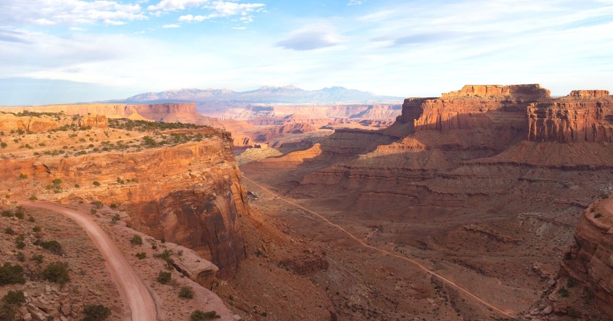
Another highlight is the Shafer Trail viewpoint, which you will come to as you head back towards the visitor center.
It gives you great views of the hairpin bends on the Shafer Road, that leads into the Canyon.
If you have the right vehicle and are an experienced driver, you can even drive this scary road yourself, but you will need a day-use permit.
Be sure to appreciate the views from the visitor center itself, which are among the most stunning in the Park.
As the day draws to a close, drive the 14 miles to the Dead Horse Point State Park, which should only take around 20 minutes.
Head to Dead Horse Point – the furthest viewpoint, at the very end of the road – to watch the sun go down in spectacular style, making a very fitting end to this Utah National Parks Road trip.
Final Thoughts On Road Tripping In Utah
As you can see, this Utah National Parks itinerary is packed with amazing things to see and do and makes the absolute most of your time in this stunning region.
With outstanding natural beauty at every turn, this is a Utah road trip you will never forget!
Needing some more USA travel inspiration? Check out one of the following blog posts:

