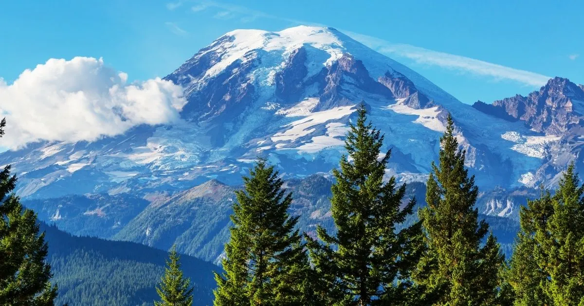
Mount Rainier is a unique US national park, famous for having the most extensive alpine glacial system outside Alaska and the most prominent volcanic glacier cave system worldwide.
Mount Rainier is also the highest volcanic peak in the USA, with a jaw-dropping height of 14,410 feet.
Ready To Travel? Don't Go Without Travel Insurance.
I recommend SafetyWing Nomad Insurance, an affordable travel insurance offering automatic monthly payments that you can cancel anytime. I've been using it since 2019, and I can assure you it's the perfect solution for nomads like you and me. Learn more by reading our SafetyWing review.Therefore, Mount Rainier is a trendy place for hiking for both pro trekkers and beginners. Covering 369 square miles throughout Washington, there are many hiking trails in Mt Rainier for all levels.
Here are eight of the best hikes in Mt Rainier, ranging from short to long and gentle to challenging.
Nisqually Vista Trail
- Area: Paradise (south)
- Distance: 1.8 km / 1.1 miles
- Duration: 30- 60 minutes
- Elevation: Minimal
- Difficulty: Easy
The Nisqually Vista Trail is a super short and gentle walk that gives beautiful views of the glacier. Therefore, it is ideal for hikers in the Paradise region who do not want to tackle the Strenuous Skyline Trail.
It’s also a quiet and lesser-known route compared to others and is exceptionally peaceful early in the morning.
As well as being an oasis of calm, there’s plenty of shade on this route. Plus, it gives lovely views of Mount Rainier and features many wildflower meadows.
To reach the trailhead, you’ll need to park at the lot at Henry Jackson Memorial Visitor Center. Then, walk the short distance east along Paradise Road until you reach the well-signposted trailhead.
Grove of the Patriarchs Nature Trail
- Area: Ohanapecosh (south east)
- Distance: 1.8 km / 1.1 miles
- Duration: 30- 60 minutes
- Elevation: Minimal
- Difficulty: Easy
The Grove of the Patriarchs is perhaps the easiest and shortest walk in Mount Rainier National Park. It is just 1 mile long with almost zero elevation gain, so it is assessable for most people.
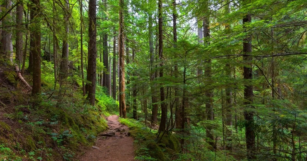
Moreover, it’s one of the best hikes in Mt Rainier for nature lovers. This is because the trail leads you deep into a wonderland of enormous old-growth trees, such as Patriarchs, Douglas Firs, and Big Cedar.
You will find the trailhead just west of the Stevens Canyon Entrance in the park’s southeast corner. The winding route features a mix of boardwalks, dirt paths, and a cool suspension bridge over the river.
The lush forest environment and calm waters give the course a very tranquil ambiance.
As this nature trail will take you no less than 1 hour to complete, it makes an excellent warm-up or cool-down to one of the more challenging hikes in the Ohanapecosh region.
So, if you have the time, it’s so worth coming to see these colossal century-old trees, some of which are 50 ft tall. Plus, the forest is full of an interesting array of fungus and mushrooms in the late summer and early fall.
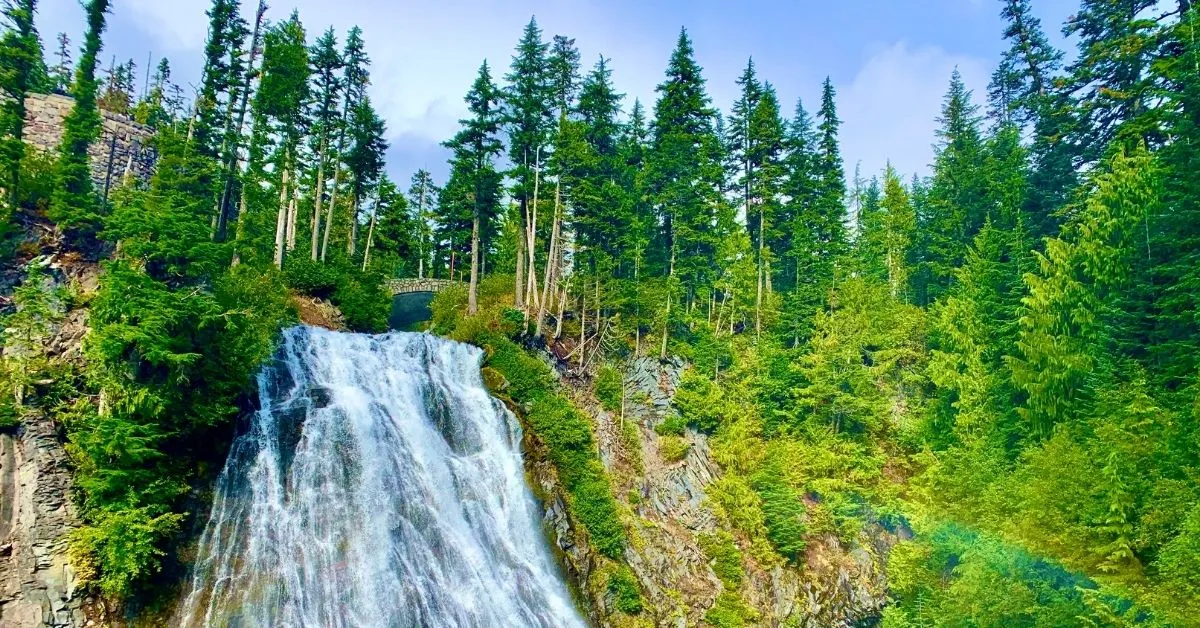
Narada Falls Trail
- Area: Paradise (south)
- Distance: 3.9 km / 2.4 miles
- Duration: 1-2 hours
- Elevation: 263m
- Difficulty: Moderate
If you’re looking for the best Mount Rainier hikes that feature waterfalls and don’t take too long, the Narada Falls Trail is one. This 3.9km route will take you around 90 minutes, starting with a descent down to the refreshing falls.
Here you can marvel at the impressive two-tier waterfall up close before heading to the beautiful Reflection Lakes that, as the name suggests, reflects views of Mount Rainier.
The climb back up from the falls is pretty steep and is why this route is marked as moderate rather than easy. However, it’s a very short distance, so it is doable.
You’ll find the trailhead in the Paradise region, south of the mountain, and you can park in the lot by Narada Falls Comfort Station.
Naches Peak Loop Trail
- Area: Sunrise (east)
- Distance: 5.3 km / 3.3 miles
- Duration: 2-3 hours
- Elevation: 194m
- Difficulty: Moderate
The Naches Peak Loop trail is not too long or strenuous but incredibly scenic, so it makes one of the best hikes in Mt Rainier for most levels.
The route takes you in a circle around Naches Peak through stunning wildflower meadows with a beautiful backdrop of Mount Rainier.
This trail is on the east side of the park, and the 5.3km loop starts at the Stephen Tyng Mather Memorial parking lot by Chinook Pass.
This hike is beautiful in the summer when the flowers are in full bloom or the fall for a different but equally beautiful perspective.
Silver Falls Trail
- Area: Ohanapecosh (south east)
- Distance: 6.4 km / 4 miles
- Duration: 2-3 hours
- Elevation: 215m
- Difficulty: Moderate
This 6.4km looped route is relatively flat, starting with an old-growth forest trail running alongside the rapidly moving Ohanapecosh River.
Eventually, you will reach a bridge that leads to the incredible turquoise-colored Silver Falls. There are also some hot springs just after the falls that you can take a short detour to visit if you wish.
The first half of the trail is gentle and downhill; however, climbing back up through the forest can be tiring. Plus, the rocks can be slippery in wet conditions, so be mindful of your footing and wear good hiking boots.
What’s more, this trail can get crowded during the day, so go before 11 am for a more peaceful walk.
You will find the trailhead at Ohanapecosh Visitor Center in the southeast corner of the park. Then, you’ll finish close by on the other side of the river by Ohanapecosh Campground, a short walk back to the parking lot.
Rampart Ridge Loop Trail
- Area: Longmire (south west)
- Distance: 7.7 km / 4.6 miles
- Duration: 3-4 hours
- Elevation: 432m
- Difficulty: Moderate
In the historical region of Longmire in the southwest part of the park, you will find another of the best Mt Rainier hikes, the 7.7km Rampart Ridge Loop Trail.
This route has an elevation gain of nearly 1,400 feet with a steady incline, so it’s not one of the most leisurely Mt Rainier hikes. Even so, the views from the ridge make the sweat and effort completely worth it.
What’s more, halfway up, you’ll enjoy a fantastic view of the Nisqually River Valley, and a large part of the trail goes through an enchanting old-growth forest.
There’s also a strong likelihood of spotting deer amongst the trees, so tread quietly and keep an eye out for these remarkable creatures.
You’ll find the Rampart Bridge trailhead close to the Longmire Wilderness Information Center and National Park Inn.
You can park at the Longmire Parking Lot, then cross Paradise Road to join Trail of the Shadows for a brief minute before taking the left turn at the fork.
Mount Fremont Lookout
- Area: Sunrise (north)
- Distance: 9.2 km / 5.7 miles
- Duration: 3 – 4 hours
- Elevation: 341m
- Difficulty: Moderate
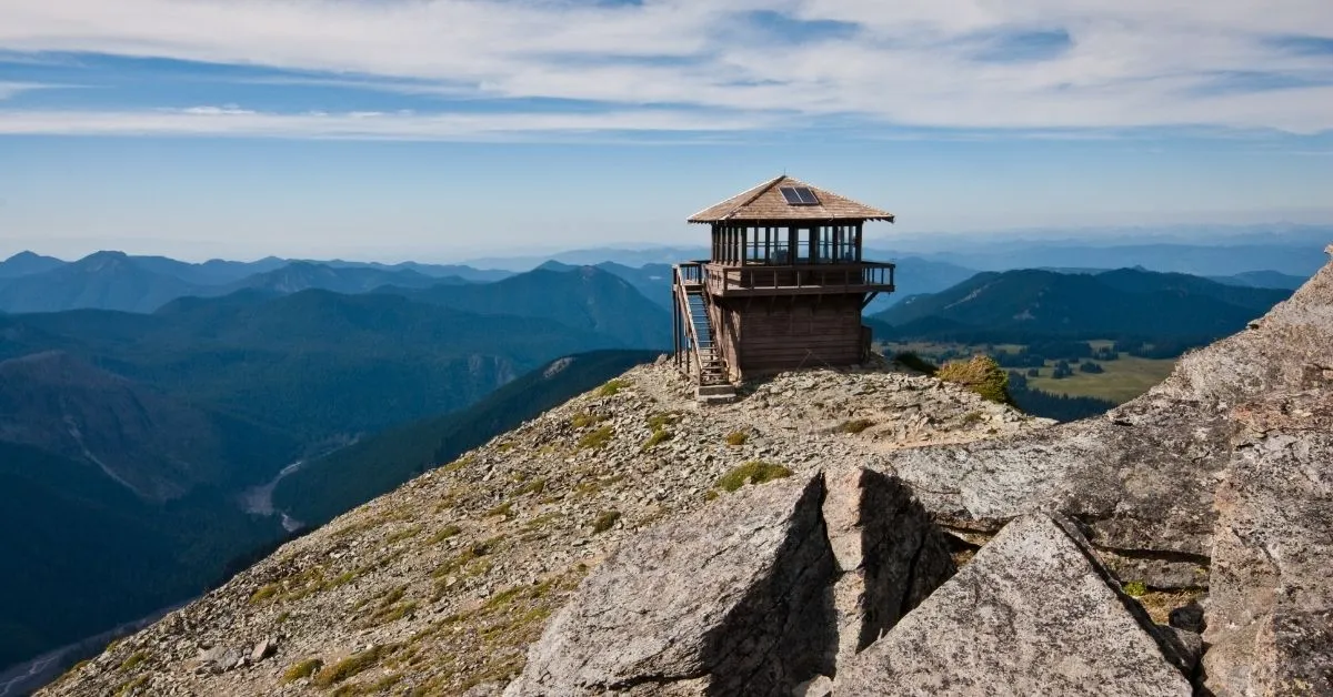
The famous Mount Fremont Lookout trail is located in the northeast part of the park in the Sunrise Region. It’s a 9.2km route that begins with a gentle stroll through the grassy meadows.
Then, the terrain changes as you start to descend to the top of one of the few remaining fire lookouts in the park.
Despite it being a long trail, there’s lots of scenery and views along the way. Plus, many animals live here so you might spot deer, marmots, or mountain goats. The lookout sits 7000 ft above sea level.
However, the elevation gain is only 700 ft as the trailhead at the Sunrise Visitor Center is already at an elevation of 6,300 ft.
Therefore, it’s moderately challenging but not too difficult, making it one of the best hikes in Mount Rainier National Park.
Skyline Trail
- Area: Paradise (south)
- Distance: 10km / 6.2 miles (full-loop) or 6.5km / 4 miles (half loop)
- Duration: 3 – 5 hours
- Elevation: 545m
- Difficulty: Hard
The Skyline Trail is the most popular hiking route on the southern side of Mount Rainier. It features incredible glacier views along with many beautiful waterfalls and rivers throughout.
The entire loop of this 10km trail is highly challenging as over two miles of the route has a significant elevation gain. If you’re up for the challenge and have the stamina and fitness level, Skyline Trail can make one of the best day hikes in Mt Rainier.
However, many hikers choose to trek just to Panorama Point and back instead, making it a shorter and easier 4-mile/6.5km hike.
You’ll find the trailhead for Skyline trail at Henry Jackson Visitor Center. You can start the loop in either direction, but most people opt to go clockwise, heading north from the trailhead.
From here, it’s just 1.5 miles until the turn-off for the stunning Glacier viewpoint. Then, a further 0.5 miles from here and you will reach Panorama Point.
Final Thoughts On Hiking Mt Rainier
These eight best hikes in Mt Rainier offer something for everyone, from forest walks to waterfall climbs to stunning viewpoints. So, whatever you’re looking for and whatever your fitness level, you’ll find many excellent hiking trails in Mt Rainier.
Of course, whichever track you choose, wear proper hiking shoes and take sufficient water when hiking in Mt Rainier.
Need a good playlist for hiking? Read about the best hiking songs.
Love hiking the USA? Read one of the following guides: