If you are traveling in the UK and want to add nature time and outdoor activity to your trip, you may want to check out some easy walks in the Peak District in Northern England.
The Peak District is Britain’s first national park, established in 1951. It boasts diverse scenery, ranging from rolling hills to caves and massive peaks, and broad valleys.
The Peak District is easy to reach from many of the country’s large cities, such as Sheffield and Manchester. As a result, the national park welcomes more than 22 million visitors each year, many of which come to explore the area’s renowned walking and hiking trails.
As the national park spans 268 miles (431 kilometers), you’ll find plenty of nature trails to enjoy, no matter your hiking ability or experience. These eight easy walks in the Peak District are ideal for those new to hiking or looking for a relaxing countryside getaway.
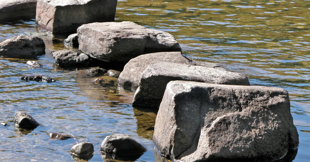
Dovedale Stepping Stones
- Distance: 1.3 miles (2.1 kilometers)
- Duration: 30 – 45 minutes
We start the list with one of the most popular easy walking trails in the Peak District, the famous Dovedale Stepping Stones. These stepping stones were placed in the River Dove in the south of the national park in the late 19th century to help tourists cross the dale and connect Staffordshire and Derbyshire.
The Dovedale Stepping Stones Walk is surrounded by ancient woodland that boasts a tranquil ambiance. Therefore, it’s no surprise that the limestones have become a unique and popular attraction among park visitors.
As a result, this is one of the busiest parts of the park. Therefore, if visiting in the summer, expect to queue a while to allow others to cross.
Although the stepping stones require careful attention and focus, the entire walk is flat, making it a leisurely stroll for most. The main Dovedale Stepping Stones trailhead is at Dovedale Car Park.
However, you can also park in the lot at Ilam Park and walk for an extra mile if you want to extend your hike.
Sett Valley Trail
- Distance: 2.5 miles (4.2 kilometers)
- Duration: 45 – 75 minutes
If you’re looking for short hikes in Peak district, you’ll find one of the best ones on the western outskirts of the national park.
The Sett Valley Trail hugs the lower valley of the River Sett and follows an old railway line, linking the two small towns of New Mills and Hayfield. Therefore, this walking route combines village life, nature reserves, and river vistas.
The Sett Valley trailhead is located at the parking lot on station road in Hayfield. Here there is also an information center, picnic area, and toilets.
Aside from being a walking route, the trail is also a cycle path and a popular local bridleway, so you’ll likely see some horses along the way.
Mam Tor Walk
- Distance: 3 miles (4.8 kilometers)
- Duration: 1 – 1.5 hours
The 3-mile (4.8 kilometers) circular Mam Tor Walk near Castleton is one of the most famous hikes in Peak District. Mam Tor means “mother hill” because the 1,696 feet-high (517 meters) hill has multiple landslides on its eastern side that have created numerous “mini-hills” below.
As you would expect, this walking trail has a fair amount of incline, but luckily the climb is short. Therefore, after a bit of effort, you’ll reach the top and be rewarded with panoramic vistas stretching across Edale Valley and as far out as Kinder Scout.
The Mam Tor trailhead is at the Mam Tor National Trust car park, about 2 miles (3.2 kilometers) from Castleton. From here, follow the stone footpath, the route features signs with the National Trust logo, so you won’t get lost.
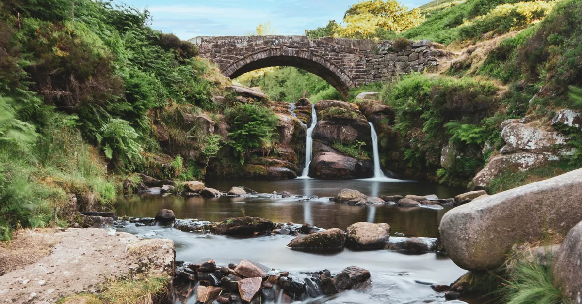
Three Shires Head
- Distance: 4 miles (6.4 kilometers)
- Duration: 2 – 2.5 hours
Three Shires Head is a famous small waterfall on the western side of a park and a unique spot where Derbyshire, Staffordshire, and Cheshire meet.
The short 4-mile (6.4 kilometers) walk features pools, bridges, and waterfalls and is surrounded by beautiful untouched nature. The route has some slopes and a total elevation of 941 feet (287 meters), yet it is still gentle enough to be rated as one of the best easy walks in the Peak District.
It’s also one of the most popular summer trails as it makes a beautiful picnic spot. The refreshing water is also ideal for cooling off on a hot day.
The walk begins in Gradbach, and Three Shires Head trailhead is at the left-hand corner of the Gradbach Mill Lane parking lot. Follow the path next to the stream, crossing a wooden footbridge with the river on your left.
The route is signposted in some parts, but it’s best to download the map on your phone beforehand.
Ladybower Reservoir Walk
- Distance: 5 miles (8 kilometers)
- Duration: 1.5 – 2.5 hours
The Y-shaped Ladybower Reservoir close to Hope Valley is one of the best easy walks in the Peak District. The circular route is gentle and essentially flat, following well-made paths.
The reservoir is surrounded by gorgeous forest and moorland scenery and is a leisurely stroll for most people. The Ladybower Reservoir trailhead is at Fairholmes Visitor Information Center.
From here, turn left to begin the walk. The course has a total elevation gain of 558 feet (170 meters).
Still, you won’t have to tackle steep sections as the incline is gradual throughout.
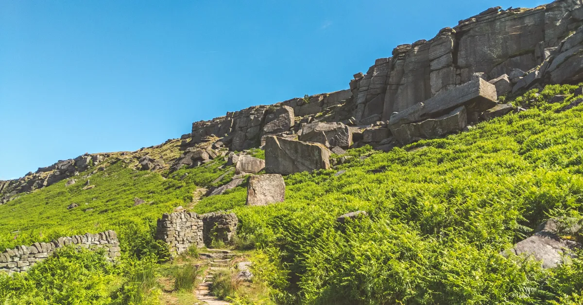
Stanage Edge Via Robin Hood Cave
- Distance: 7.4 miles (11.9 kilometers)
- Duration: 3 – 4 hours
Stanage Edge is one of The Peak District’s most visited parts that are popular with rock climbers but also an excellent place for walking. The elevated gritstone escarpment offers stunning views of the natural surroundings such as Derwent Valley.
Stanage Edge is 3.5 miles (5.6 kilometers) long, so to walk the entire route and back makes it a 7-mile (11.3 kilometers) walk.
However, you should not forget to take a short detour to Robin Hood Cave. The hidden cliffside cave where it is believed Robin Hood used to take shelter.
There is a total elevation gain of 1,073 feet (327 meters), which takes a few hours to complete. Still, the magnificent vistas you get along the route make it one of the best hikes in Peak District for all levels.
The Stanage Edge trailhead is at Hooks Carr Car Park.
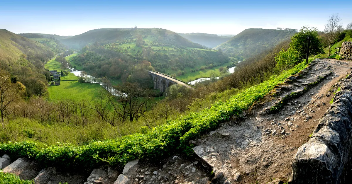
The Monsal Trail
- Distance: 8.5 miles (13.7 kilometers)
- Duration: 3.5 – 4.5 hours
The Monsal Trail in the center of the natural park is another walking route that follows a former railway line. The 8.5-mile (13.7 kilometers) track takes around 4 hours to complete, so you’ll need to plan an entire morning or afternoon for this one.
The railway was built in 1863 but closed in 1968. Since then, it has served as a walking, cycling, and horse riding trail.
It runs from Blackwell Mill in Chee Dale to Coombs Road in Bakewell. The Monsal Trailhead is by the Chee Dale Layby by River Wye.
This route is special because it encompasses various tunnels, such as Headstone Tunnel and Cressbrook Tunnel. They are about 1,312 feet (400 meters) long and lit during the daytime, so walking through them makes for a unique experience.
Aside from the tunnels, it passes some fantastic sights like the dale of Water-cum-Jolly.
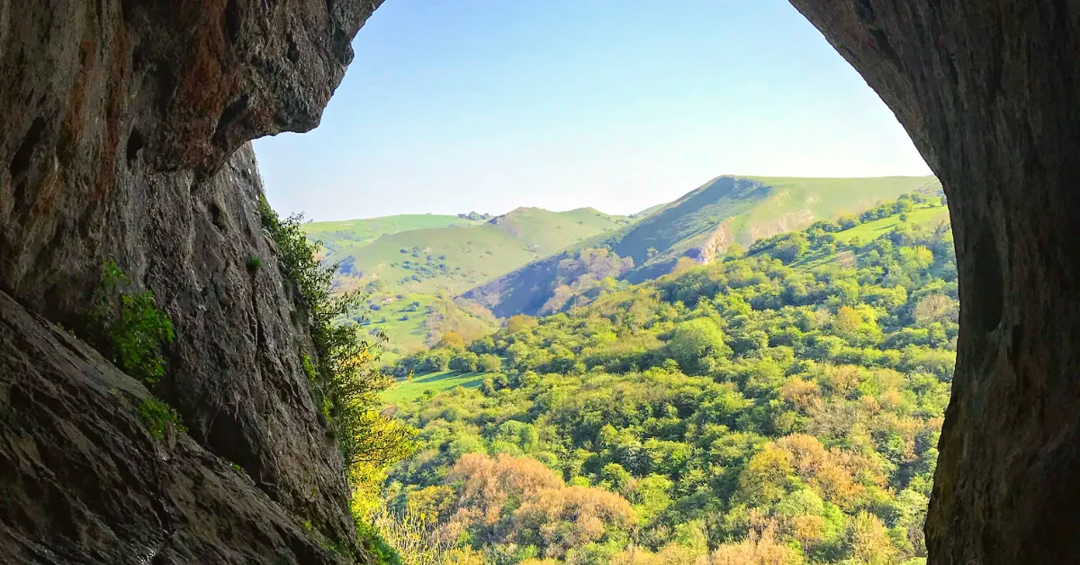
Thor’s Cave Walk
- Distance: 4.7 miles (7.6 kilometers)
- Duration: 2 – 3 hours
Thor’s Cave in Wetton is the largest cave you can enter for free or without a tour guide in The Peak District. While the cave is impressive, the 4.7-mile walking route (7.6 kilometers) from Wetton Village is highly scenic.
Thor’s Cave is the first stop on the walk, then afterward, the route leads to Manifold Valley. From here, it loops back to Wetton Mill, where there are some smaller caves to explore.
You’ll find the Thor’s Cave trailhead at Wetton car park on Carr Lane.
Final Thoughts On Hikes In Peak District
The Peak District is a walker’s haven and one of the most beautiful areas in the UK.
However, these 8 best walks in Peak District are just a handful of the 80+ trails in the national park. Therefore, we recommend spending at least a weekend and staying in one of the nearby traditional villages at a cozy cottage in the Peak District.
Need more inspiration in the UK? Read one of the following guides: